One of the most effective ways to increase the chances of catching fish is by utilizing charts. There are a variety of charts that help anglers find fish and determine when to fish, how to fish, and more. Between the salt and freshwater opportunities across the United States, here are 4 fishing charts to help you catch more fish.
Fish Identification Charts With Fishing Tips
Depending on the experience of the angler, fish identification charts are beneficial. The chart identifies fish and most frequently provides tips for baits, lures, and techniques.
Fish identification charts are available for purchase or free resources by counties, states, and parks.
Visit bait and tackle shops or welcome centers at parks for materials on fishing. When purchasing guides, select a book that covers the type of water you will be fishing. For example, buy a saltwater fish identification guide when fishing in saltwater. Florida Sportsman prints the most popular and informative books.
Free printed fishing materials are equally as effective. When casting a line, color charts provide detailed pictures, size limits, bag limits, and other pertinent information to make your day more enjoyable and avoid risking harvesting illegal fish.
Tidal Fishing Charts
When fishing coastal waters, tides significantly influence the migration of fish depending on the phase.
Tide charts prepare anglers before heading out to the bank or on the boat for a day of fishing.
Tidal charts are available online and at local bait and tackle shops. Keep a printed version on hand or monitor via a phone when out on the water. Read these 4 tips to know when to catch fish based on tides.
Boating Safety
Boaters must take extra precautions when tides fluctuate to avoid becoming stranded as the water level lowers. Know when to pull out of creeks and flats using a tide chart before it’s too late.
Catching Fish
Don’t hesitate to break out the tide chart to determine where and when to find fish. Fish migrate from deep pools to food-filled flats and marsh grass as the tide rises.
Conversely, as the tide falls, the fish move out of the grass and flats and into deep pool where they lounge until the water pours back inland.
Using a tide chart will keep you on the fish compared to scrambling and wondering where they went. Check out the online tide chart at Tide Forcast. Tides can be monitored in real-time on your phone when fishing.
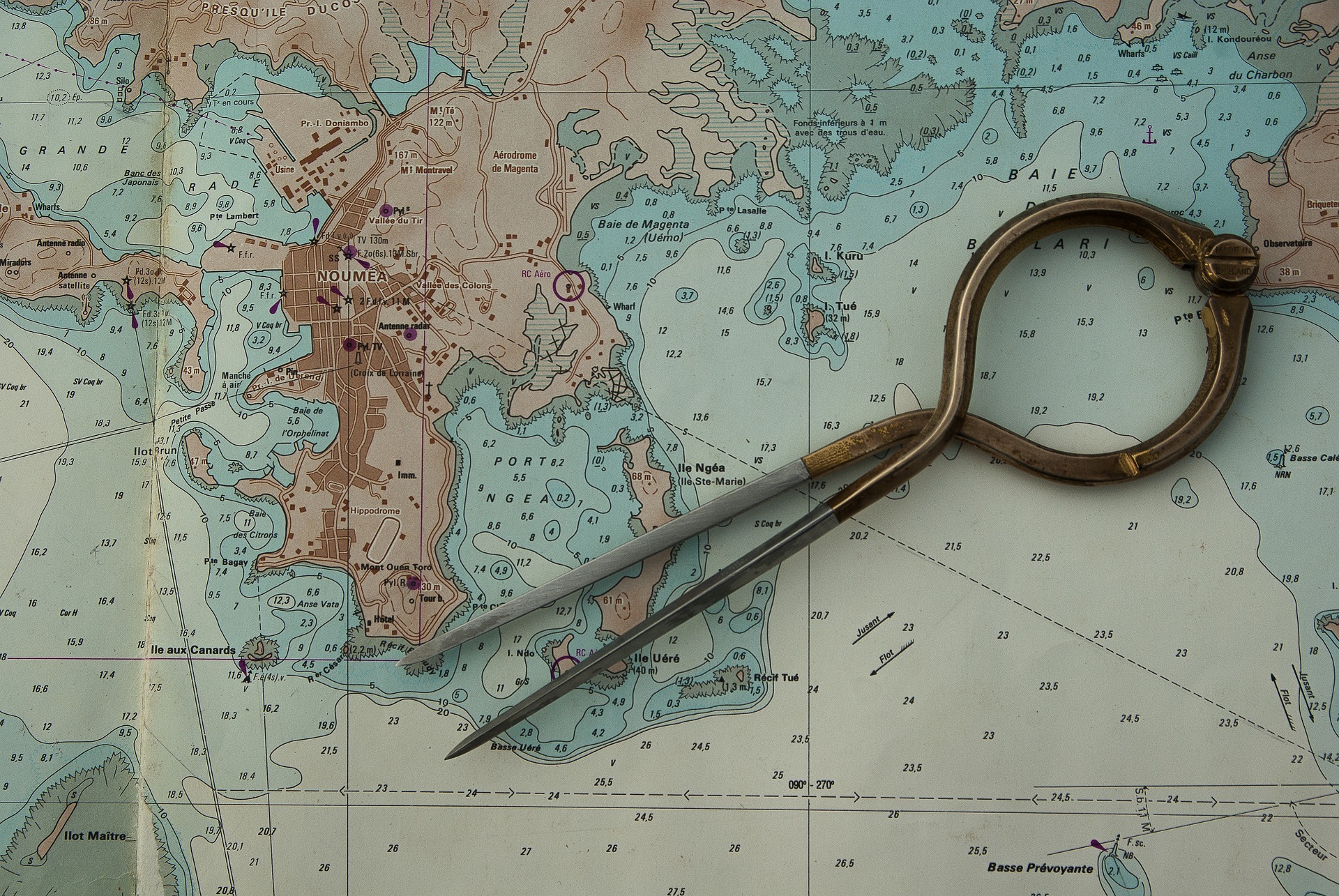
Paper and Electronic Fishing Charts
Despite paper charts being a thing of the past, they are a great resource when planning a fishing trip before departing. Electronic fishing charts provide real-time information on the screen in front of you when operating a boat. Here are the benefits of using paper and electronic fishing charts.
Paper Fishing Charts
Paper charts were once the most trusted resource to navigate waters. Today, paper charts are effective before leaving the dock when planning a day of fishing.
Lay a paper chart of the waters you are fishing on a table inside of a home. Review the chart for changes in depth, rock piles, sand bottoms, artificial or natural reefs, and the depths of creeks or other waterways.
Determine the type of fish you chose to target and select locations that fish are likely to hold. Preparing ahead of time will save time rather than running and gunning for gamefish.
Electronic Charts
There are two types of electronic charts. The first is onboard navigation systems that display your position, depths, and layout of the water and land in your surroundings. Secondly, the National Oceanic And Atmospheric Administration makes charts available online. Review online charts before leaving the dock.
The benefit to utilizing marine charting systems when fishing is monitoring the movement of the boat in relation to the bottom or shore structure. Electronic charts significantly benefit the angler.
Fishing Hotspots Fishing Charts
A company called Fishing Hotspots creates digital and printed fishing charts. The fishing charts indicate prime fishing zones for fresh and saltwater anglers. Here is a look at the printed and digital Hotspots Charts.
Printed Hotspots Charts
We have had the opportunity to use numerous Hotspots fishing charts across the country. The material is waterproof and tearproof to stand up to the elements.
Utilize the fishing resource for navigation, fishing tips, launch access, and topography details.
Digital Hotspots Charts
The digital Hotspots charts load detailed fishing, navigation, and other information into Raymarine marine electronics by a card.
Rather than needing to hold a chart in hand, catch a glimpse of the screen which is pre-loaded to help put you on the fish faster.
Fishing Charts Come In Many Forms
Anglers must take advantage of all of the resources available to help find fish in short order. Utilize fish identification charts, tide charts, paper and electronic charts, and Hotspots charts to make your line tight sooner than later. We have used all four forms in conjunction and can attest to the benefits.